Activities & Events

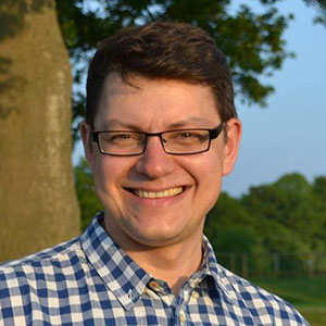
  • BEGIN seminar – Dr Dmitry Kishkinev

    Date: 30 November 2021
    Time: 15:00-16:00
    Venue: The link for the event will be sent on the morning of the 301th to those that RSVP

    Please RSVP at [email protected] until Mon 29th of June to receive the link.
    All welcome!

    The role of the Earth’s magnetic field for animal orientation and navigation

    How can birds, sea turtles, migratory butterflies and many other animals find their way to intended destinations travelling 1000’s of miles sometimes across completely unfamiliar territories without access to satellite navigation technologies? What cues and senses do animals use for navigation? How can animals perceive changes of the Earth’s magnetic fields and can they use the Earth’s magnetic field (EMF) for navigation? How can human-made rapidly expanding electromagnetic noise produced by telecommunication infrastructure affect and disrupt animal’s behaviour? These questions are in the heart of my research. I am particularly interested in unravelling the mystery of the animal’s magnetic sense to understand how this sensory system works in detail and what role it plays for animal navigation. In this seminar, I will provide an overview of the recent advances in this field and discuss an accumulating body of evidence proving that a large range of species use EMF for direction-finding and at least some animals such as migratory birds and fish can use geomagnetic parameters for finding their location relative to migratory goals (i.e. for navigation).

    Primer article in The Conversation based on our recent study:
    https://theconversation.com/birds-use-massive-magnetic-maps-to-migrate-and-some-could-cover-the-whole-world-154992

    Birds use massive magnetic maps to migrate – and some could cover the whole world – The Conversation
    Regardless, if birds have learned that magnetic intensity increases as they go north, they should be able to detect their position on the north-south axis wherever they happen to be.
    theconversation.com

    Biography

    Academic positions

    2019-present: Lecturer in Animal Behaviour and Behavioural Neuroscience, Keele University.
    2017-2019: Leverhulme Early Career Fellowship, Bangor University, UK.
    2014-2017: Postdoctoral Research Assistant, in Queen’s University Belfast (2014-2016) then Bangor University (216-2017), UK.
    2012-2014: Banting Postdoctoral Fellowship (Natural Sciences and Engineering Research Council of Canada, NSERC), University of Guelph, Ontario, Canada.
    2011-2012: Postdoctoral Researcher, University of Oldenburg, Germany.
    2006-2011: PhD (Biology), University of Oldenburg, Germany.
    2003-2005: MSci in Biology, St Petersburg State University, Russia.

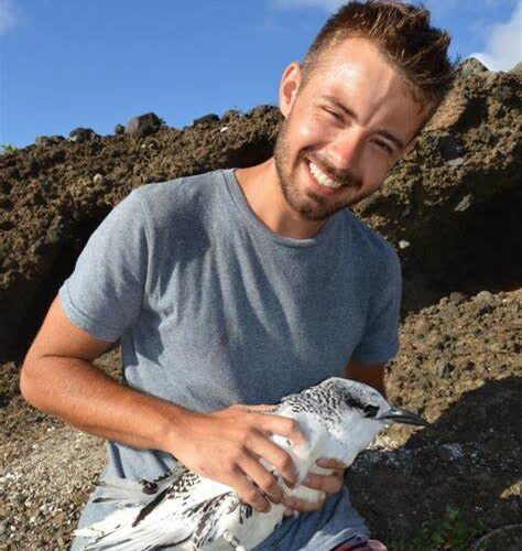
  • BEGIN seminar – Adam Fell, PhD candidate at the University of Stirling

    Date: 21 September 2021
    Time: 15:00-16:00
    Venue: The link for the event will be sent on the morning of the 21th to those that RSVP

    Please RSVP at [email protected] until Mon 20th of June to receive the link.
    All welcome!

    Navigating fragmented tropical landscapes: understanding how forest fragmentation affects frugivore behaviour

    Movement is essential for all organisms, whether it be passive or active, or across local, regional, or global scales. Movement underpins almost all aspects of an animal’s lifecycle, from the acquisition of food, mate choice, reproduction, and is intrinsically linked to broader ecosystem processes such as seed dispersal. Frugivorous animals move seeds from the parent plant to the site of germination. We can leverage recent technological advances in animal tracking to better understand frugivore movement and seed dispersal.
    The purpose of this study is to provide a unique, comprehensive review and synthesis of the existing primary literature of tracking studies that use either GPS or radio telemetry to monitor movement of frugivorous animals on a global scale. We aim to provide a historical overview of the evolution and expansion of tagging technology. Specifically, we also evaluate the quality and quantity of data collected through the use of different tracking methods, and how this has changed over time. Furthermore, we assess the seed dispersal distances of frugivorous animals and assess which species and environmental traits best predict seed dispersal distances.
    We provide both a quantitative and narrative synthesis of all current published literature that focus on the movement of frugivorous animals using tracking devices. We provide a comprehensive description of the study focus, the species of interest, the tracking method used, and the amount of data collected. We collated the mean and maximum seed dispersal distances of species from all seed dispersal studies.
    A total of 148 peer-reviewed research studies were reviewed across a 42-year period. Of these, 62 studies focussed on seed dispersal and estimated dispersal distances. Our data illustrates that there has been a shift in tracking methods over time; with increased use of GPS tags post 2005, and especially for larger animals. GPS units have the potential to collect more data over longer periods. We found that seed dispersal distances increased significantly with body mass and ability to fly.
    We suggests ways in which future movement studies can be standardised to help aid analysis and future replications, for example reporting all raw movement data and remaining consistent with keywords. These results also emphasise the importance of understanding the movement patterns of frugivorous animals to characterise seed dispersal distances. Seed dispersal is essential for the effective regeneration of many plant species and improved understanding of frugivore movement can help us understand patterns of plant regeneration at the landscape scale.

    Biography

    I have a special interest in understanding how animals are responding to an ever-changing world. And in particular, their behavioural responses to habitat changes. My previous research has seen me study the social interactions and behaviour of orphaned chimpanzees in Uganda to assess the likelihood of these individuals forming a troop hierarchy similar to their wild counterparts. For my master’s thesis, I explored how the foraging ecology of the red-tailed tropicbird in Mauritius is affected by changes in climate and assessed their energetic costs during prey encounters using onboard accelerometers. The ongoing development of tracking technology is another interest of mine and is something which I think will continue to help advance our understanding of animal behaviour. For my PhD project, I will be focusing on understanding how forest fragmentation affects bird behaviour in the tropical landscapes of Panama. Currently very little is known about how birds disperse and shift movement patterns with regards to habitat fragmentation. Something which seems pretty vital to understand, given that large populations of humans depend solely on ecosystem services produced by tropical forest species e.g. seed dispersal and pollination. Therefore, this project will aim to track multiple frugivorous bird species with state of the art GPS loggers to better understand their movement patterns across a deforested landscape gradient. We predict that species life-history and morphological traits will interact with landscape composition to determine dispersal among the different habitats. This information can then be used to assess the seed dispersal potential of frugivorous birds and the likelihood of deforested landscapes undergoing regeneration through natural succession.

  • BEGIN seminar – Ms Anita Graser

    Date: 15 June 2021
    Time: 15:00-16:00
    Venue: The link for the event will be sent on the morning of the 15th to those that RSVP

    Please RSVP at [email protected] until Mon 14th of June to receive the link.
    All welcome!

    Exploratory Spatial Data Analysis

    Spatial data visualizations are powerful communication and data exploration tools. This talk looks into recent geospatial technology developments and how they can help experts perform spatial analyses and present their results. Technologies covered include open source desktop GIS as well as novel notebook-based tools. The presented use cases focus on the mobility/transport domain and highlight the challenges of analyzing and visualizing corresponding spatiotemporal phenomena in GIS environments.

    Biography

    Anita Graser is a researcher, open-source GIS developer, and author. She works at the AIT Austrian Institute of Technology in Vienna, teaches Python for QGIS at UNIGIS Salzburg and serves on the QGIS project steering committee. She has published several books about QGIS, including “Learning QGIS” and “QGIS Map Design”. Her latest project is MovingPandas, a Python library for analyzing movement data. You can find out more about her work on anitagraser.com and follow her on Twitter @underdarkGIS.

  • BEGIN seminar – Ms Mariane Souza Reis

    Date: 18 May 2021
    Time: 15:00-16:00
    Venue: The link for the event will be sent on the morning of the 18th to those that RSVP

    Please RSVP at [email protected] until Mon 17th of May to receive the link.
    All welcome!

    Land cover and land change mapping using Synthetic Aperture Radar data in Amazon

    Monitoring land use and land cover changes in the Brazilian Amazon has become a relevant scientific topic, with different remote sensing operational systems being designed to monitor the region over time. However, the majority of these projects are based on optical data, which are strongly affected by clouds, smoke, and other weather and atmospheric conditions. In areas like the Brazilian Amazon, where cloud cover is frequent throughout the year, obtaining optical data with low cloud coverage at certain periods of the year is a difficult task. Synthetic Aperture Radar (SAR) data are obtained almost independently of weather conditions and are able to capture information about the land surface in cloud-covered areas, being strong candidates for forest monitoring. However, SAR data are more difficult to interpret and process than optical data and are freely available for short periods. In this talk, I aim to discuss some land cover and land change classification results obtained using SAR data in a region along the Lower Tapajós River, within the Brazilian Amazon, which illustrates how SAR data can be used to supply traditional optical monitoring projects.

    Biography

    Mariane Souza Reis received a B.S. degree in environmental engineering from the Pontifícia Universidade Católica de Campinas, Campinas, in 2011, and an M.Sc. degree in remote sensing from the National Institute for Space Research (INPE), São José dos Campos, Brazil, in 2014, where she is currently pursuing a PhD in Earth System Science. From 2014 to 2016, she held a scholarship to work with INPE in land cover monitoring with optical and Synthetic Aperture data, the collection of field information (Amazon), and the development of image processing algorithms. Her research interests include land use and land cover analysis and image processing techniques.

  • BEGIN seminar – Dr Roderik Lindenbergh

    Date: 20 April 2021
    Time: 15:00-16:00
    Venue: The link for the event will be sent on the morning of the 20th to those that RSVP

    Please RSVP at [email protected] until Mon 20th of April to receive the link.
    All welcome!

    3D environmental monitoring from top to bottom

    Our 3D environment is constantly changing due to natural and anthropogenic impact. For monitoring these changes several geometric remote sensing techniques are available. Among them, laser scanning is able to efficiently acquire dense elevation data at cm level. Laser scanning is available at different scales, from pocket size panoramic scanners to spaceborne systems like ICESat-2 and ISS-GEDI. In this talk, I will give an overview of different systems, and of challenges associated with processing laser scanning point clouds. The bottom of 3D environmental monitoring is represented by coastal permanent laser scanning, where a laser scanning is measuring beach topography for months in a row at hourly intervals. The top is represented by our experiences with ICESat-2 and ISS-GEDI LiDAR data over The Netherlands, the Austrian Alps and the Tibetan plateau. In between, two 3D environmental monitoring project on slow moving landslides and the Antarctic Peninsula will be discussed, where the related techniques of InSAR and photogrammetry are used.

    Biography

    Roderik Lindenbergh is associate professor in digital terrain analysis and laser scanning at Delft University of Technology. After obtaining his PhD in Mathematics on Geometry and Topology at Utrecht University he joined the current Dept. of Geoscience and Remote Sensing in Delft. His main interests are methodology for digital terrain analysis and terrain change detection, including machine learning and interpolation techniques, and methodology for processing laser altimetry data, at all scales, from close range panoramic scanners up to satellite systems.

  • BEGIN seminar – Mr Kamil Smolak

    Date: 16 March 2021
    Time: 15:00-16:00
    Venue: The link for the event will be sent on the morning of the 16th those that RSVP

    Please RSVP at [email protected] until Mon 15th of March to receive the link.
    All welcome!

    Disease spread modelling

    Although currently, disease spread modelling is currently a popular topic, it has been present in science for years. Starting from the differential-equations-based model presented by Bernoulli in the 18th century, through compartmental models to dynamic human mobility simulations, this presentation shows why the disease spread modelling is a fast-evolving discipline with a long history and a bright future. This presentation demonstrates in practice how disease spread models work, building up from the simple model up to more complex solutions. Finally, it shows how evolving science of human mobility can contribute to disease spread modelling.

    Biography

    Kamil Smolak has completed an MSc in Geodesy and Cartography at Wroclaw University of Environmental and Life Sciences (UPWr) and is a PhD student at the same university. His research interests are human mobility modelling, privacy protection, mobility prediction, and machine learning.

  • BEGIN seminar – Dr Orit Peleg

    Date: 16 February 2021
    Time: 15:00-16:00
    Venue: The link for the event will be sent on the morning of the 16th those that RSVP

    Please RSVP at [email protected] until Mon 15th of February to receive the link.
    All welcome!

    The physics of firefly communications: Principles and predictions

    Fireflies offer a unique and rare glimpse into animal communication. Their signal comprises a species-specific on/off light pattern repeated periodically, used by individual fireflies to advertise themselves to potential mates. Detecting individuals becomes increasingly challenging at high densities of fireflies. In this talk, I will explore how fireflies approach this problem while using physics and information-theory concepts, e.g., energetic cost and compression (minimization of bits representing information) and detectability (high signal-to-noise-ratio). The first approach involves signal amplification via synchronization within swarms containing tens of thousands of individuals. Our recent quantitative measurements of the three-dimensional spatiotemporal flashing pattern of synchronous firefly swarms allow us to validate a set of mathematical models that account for short-range spatial correlations and the signal’s emergent periodicity. The second approach involves the evolutionary design of light patterns with increased detectability at other individuals’ expense. Using a computational model, we observe an emergent periodicity in the resulting optimal sequences and demonstrate a method of reconstructing potential cost functions from the phylogenetic relationships of extant species alongside their characteristic flash patterns.

    Biography

    Orit Peleg is a broadly trained physicist with a passion for living systems. Her research is aimed at understanding how organisms buffer themselves against large environmental fluctuations and accommodate adaptation over a wide range of length and time scales. This includes protein assemblies that remain intact under varying external mechanical and chemical stimuli, beetles that navigate using volatile celestial cues, and honeybee clusters that change their morphology to both withstand mechanical stresses, and to regulate their bulk temperature. Peleg is an Assistant Professor at the Computer Science Department and the BioFrontiers Institute at the University of Colorado Boulder. She draws from a multidisciplinary background; She holds a B.S. in physics and computer science and an M.S. in physics from Bar-Ilan University in Israel. She then moved to Switzerland to get her Ph.D. in materials science at ETH Zurich, and then to Boston for a Postdoctoral fellowship at Harvard University in first chemistry, and then applied mathematics.

  • BEGIN seminar – Ms Morgan Crowley

    Date: 19 January 2021
    Time: 15:00-16:00
    Venue: The link for the event will be sent on the morning of the 19th those that RSVP

    Please RSVP at [email protected] until Mon 18th of January to receive the link.
    All welcome!

    Mapping and analyzing Canadian wildfires in Google Earth Engine

    Each year, fire seasons in forested Canada are becoming increasingly variable due to the changing climate. Earth observation data is a useful way to map these unpredictable fires as they grow across the country’s vast, fire-prone regions. However, single-date and single-sourced imagery of active fires often contain clouds, flares, smoke, and haze, creating inconsistencies when evaluating burned areas over time. In my research, I apply rapid and scalable methods to synthesize information on fire progressions using freely available satellite imagery, novel image fusion algorithms, and cloud-based data processing platforms to improve upon existing fire mapping techniques. Building upon a small prototype for one 2017 fire, I applied these data fusion methods for fire progression mapping using Landsat-7, -8, Sentinel-2, and MODIS (MCD64A1 burned-area dataset) for the 2017 and 2018 British Columbia fire seasons. Using these outputs, I calculated within-year, intra-annual fire progression metrics to compare satellite-derived fire behaviours between the 2017 and 2018 fire seasons, both at the whole fire season and the individual fire level. The ultimate target of this research is to reconstruct historic wildfire progressions, cross-validate fire behaviour models, and compare fire progression metrics between historic fires and fire seasons in Canada. These methods can provide information about active wildland fire progressions to improve our understanding of fire growth and associated drivers over space and time.

    Biography

    Morgan Crowley is a Ph.D. Candidate at McGill University in the Department of Natural Resources. In her research, she fuses classifications from multiple satellite sensors to map and analyze wildfire progressions and burned areas in Canada. All of her research is done in Google Earth Engine in collaboration with the Canadian Forest Service. Outside of her research, Morgan enjoys facilitating the Ladies of Landsat organization and spending time with her dog, Athena.

  • BEGIN seminar – Dr Hannah Williams

    Date: 08 December 2020
    Time: 15:00-16:00
    Venue: The link for the event will be sent on the morning of the 8th those that RSVP

    Please RSVP at [email protected] until Mon 7th of December to receive the link.
    All welcome!

    Cost-efficient movement decisions in a dynamic landscape

    An animal’s cost of movement is determined by a combination of locomotion and environmental energies. This is defined by their energy landscape, a heterogeneous landscape of costly slopes and substrates or beneficial water currents and airflows, where movement is more or less costly, respectively. However, in dynamic and unpredictable environments it is notoriously difficult to locate favourable flows. So how do animals inform probabilistic movement decisions for reduced movement costs? Soaring birds have evolved an obligate dependence on the energy available in airflows, gliding between updrafts as energy hotspots to gain the height needed to travel cheaply without having to use flapping flight. Using Inertial Measurement Units (IMUs) I record movement at ultra-fine scales to investigate how vultures and condors gain lift from updrafts and to identify the conditions under which they are forced to use expensive flapping flight. I then theorise that in the same way that we can ‘reconstruct’ the energy landscape (using IMUs and dead-reckoning), animals may gain up-to-date information by observing the movements of other soarers in their environment as a strategy to increase certainty in movement decisions.

    Biography

    My academic life started as an undergraduate in zoology at the University of St Andrews, where a project tagging killer whales with Volker Deecke and Patrick Miller brought me into the world of Bio-logging. I then went on to an MRes at Exeter University using geolocators and stable isotopes to investigate the foraging behaviour of gannets while on Migration. I completed my PhD and first postdoctoral position at Swansea University’s Laboratory for Animal Movement (SLAM) researching space-use in soaring birds. Here I focused on the use of movement sensors to quantify flight performance of vultures and condors. I am now based at the Max Planck Institute for Animal Behavior where I am investigating the use of social information to optimise movement efficiency. Again with a focus on soaring species, exploring how animals may optimise cost-efficiency of movement when moving through dynamic and unpredictable environments.

  • BEGIN seminar – Dr Richard Streeter

    Date: 24 November 2020
    Time: 15:00-16:00
    Venue: The link for the event will be sent on the morning of the 24th to those that RSVP

    Please RSVP at [email protected] until Mon 23rd of September to receive the link.
    All welcome!

    Using UAVs (drones) to assess spatial patterns of erosion in a high-latitude rangeland, Iceland

    High-latitude areas are experiencing rapid change: we therefore need a better understanding of the processes controlling soil erosion in these environments. In this talk I describe how drones were used as part of a spatiotemporal approach to investigate soil erosion in Svalbarðstunga, Iceland (66°N, 15°W), a degraded rangeland. We used three complementary datasets: (a) high- resolution unmanned-aerial vehicle imagery collected from 12 sites (total area ~0.75 km2); (b) historical imagery of the same sites; and (c) a simple, spatially-explicit cellular automata model. We found that there was no simple relationship between location along the environmental gradient and the spatial characteristics of erosion. The importance of abiotic processes to the growth of large erosion patches and their relative insensitivity to current environmental conditions makes it likely that the total eroded area will continue to increase, despite a warming climate and reducing levels of grazing pressure. I will also talk about how future research plans in this area will use UAVs.

    Biography

    Dr Richard Streeter is a Lecturer in Environmental Geography at the University of St Andrews. His research focusses on three main areas: volcanic ash (tephra); human-environment interactions over the Holocene, and spatial patterns of land-degradation over decades-centuries.